Solar energy in India is gaining popularity in India as its adoption continues to grow over time. This observation is significant as India’s 14th National Electricity Plan (NEP14) sets ambitious solar capacity targets of 185.6 GW by the fiscal year 2026-27, and 364.6 GW by the fiscal year 2031-32.
Strategic planning and precise site assessment are essential for maximizing efficiency and profitability in the solar power industry. However, traditional ground surveys are often time-consuming and resource-intensive, leading to project delays. To address this, drone technology is Improving the process by providing faster and more accurate data collection.
Drones capture high-resolution imagery and detailed terrain data, enabling the creation of topographical maps and digital models in just days instead of weeks. This rapid, precise assessment accelerates project design cycles and also optimizes solar panel placement for maximum energy output. Thus, using drones for operations in solar energy in India is becoming a fundamental shift towards more sustainable practices.
Phase 1: Site Assessment
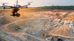
Drones with advanced sensors provide a faster and more efficient alternative to traditional ground surveys. By rapidly capturing high-resolution data, they enable the creation of topographical maps and digital terrain models in a fraction of the time, reducing site assessment timelines from weeks or months to just a few days.
One key advantage of drone-based surveys is their ability to conduct precise site evaluations. This allows developers to analyze factors like sunlight exposure, shading patterns, and terrain variations to optimize the placement of solar panels for maximum efficiency.
Additionally, drones minimize the need for extensive ground teams and heavy machinery, significantly lowering labor costs and reducing the assessment process's environmental footprint. The detailed imagery and data collected provide engineers with a comprehensive view of site conditions, including hydrology and shadow analysis, ensuring more accurate project planning.
Leveraging drone technology can accelerate solar project design cycles by up to 50%, while faster and more precise data collection can reduce project implementation timelines by as much as 70%. Thus, drones are an indispensable tool for streamlining solar infrastructure development in India and improving overall efficiency.
Phase 2: Panel Installation
Drones play a crucial role in enhancing the efficiency and accuracy of solar project development. By capturing high-resolution aerial images and precise measurements, they enable project managers to design optimized solar panel layouts remotely, reducing the need for extensive on-site resources.
Beyond initial planning, drones facilitate continuous monitoring of construction progress, allowing teams to identify potential issues early and make timely adjustments. This proactive approach minimizes delays and helps control project costs.
Accurate panel positioning is essential for maximizing solar energy capture, and drones streamline this process by providing precise data for optimal placement. Additionally, they assist in verifying that each installation is complete, safe, and meets quality standards. The detailed data collected ensures that the as-built conditions align with the original project plans, improving overall project accuracy and efficiency.
Phase 3: Performance and Maintenance
Drones equipped with thermal imaging cameras provide a fast and efficient way to detect “hot spots” on solar panels, indicating underperformance or potential malfunctions. This targeted approach helps maintenance teams focus on specific problem areas, reducing downtime and optimizing energy production.